Confederate E. Porter Alexander’s Map of the Action at Blackford’s Ford, 7/18/1861 (Courtesy of Manassas National Battlefield Park)

Harper’s Weekly Map of the Battlefield 8/3/1861 (see here)

D. B. Harris Sketch Map (Courtesy USNPS, MNBP)

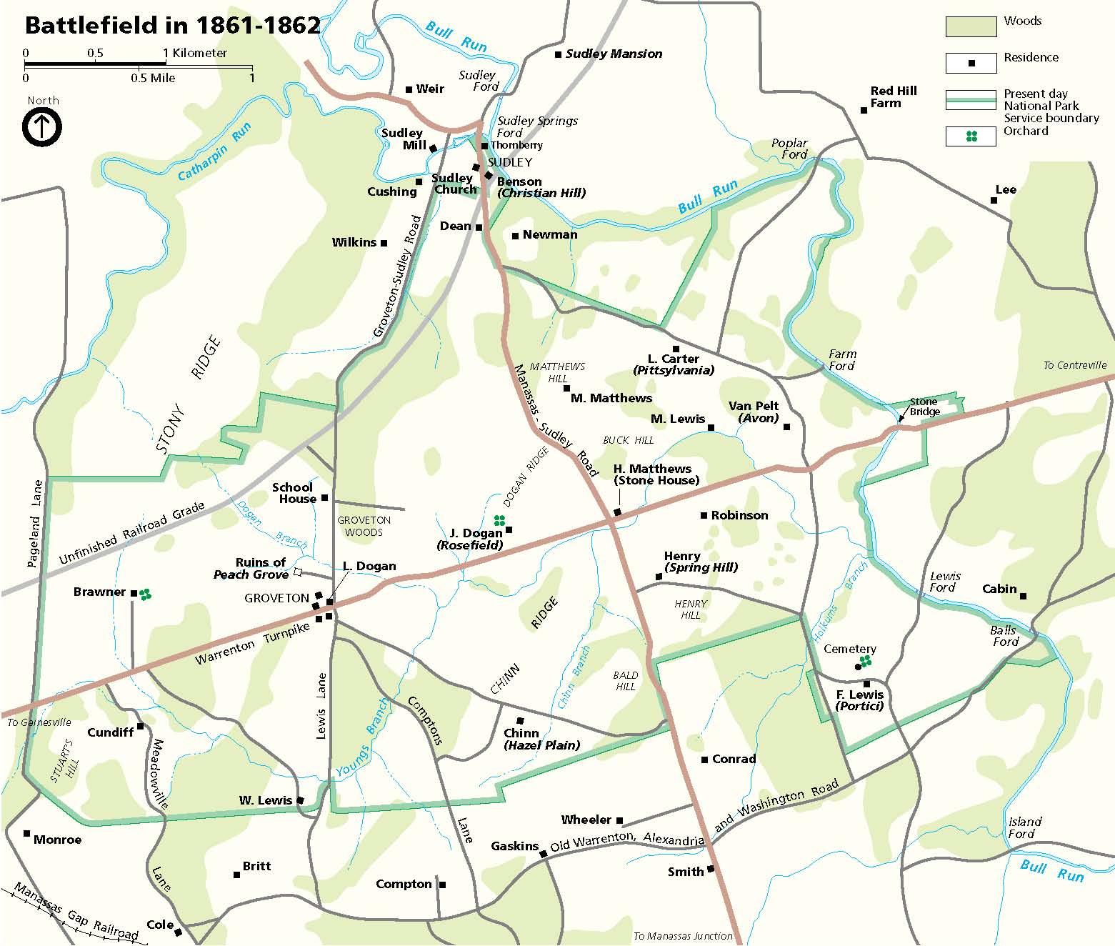
NPS Map of the Battlefield 1861-1862
West Point Atlas of the Civil War: Situation July 18, 1861

West Point Atlas of the Civil War: Situation 1400 Hours July 21, 1861

Unknown Map of Battlefield (see this post for key and citation)

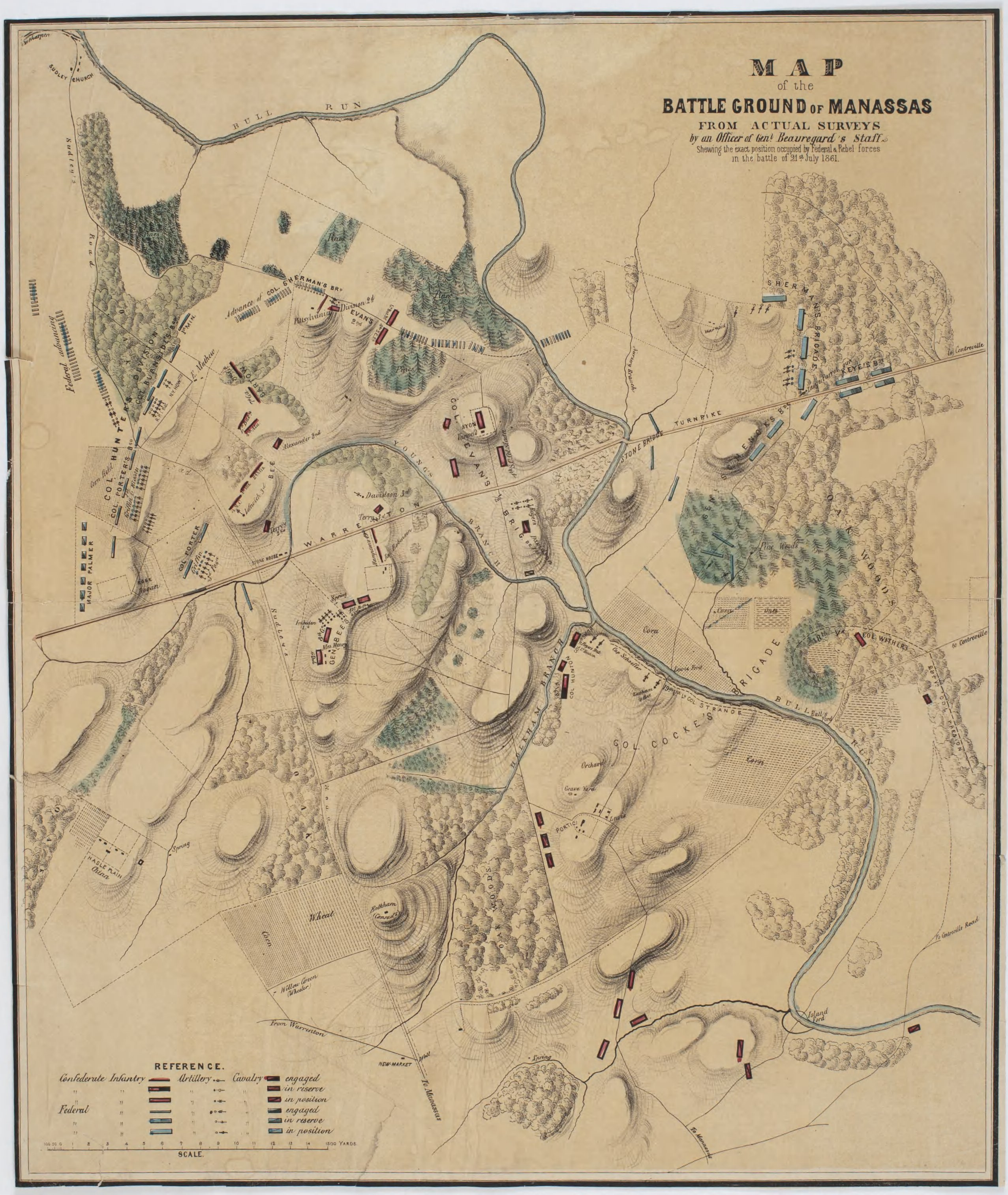
Post-war map based on surveys by an officer of Beauregard’s staff (details here).
6th North Carolina Ravine (Contributed by John Hennessy)

Map by Capt. Porter King, Co. G, 4th Alabama Infantry of fight on Matthews Hill (Library of Congress)

Map by Lt. John Calvin Reed, Co. I, 8th Georgia Infantry, of fighting on Matthews Hill (see this post)

Map of the battlefield by Lt. W, G. Atkinson (Library of Congress)


[…] on July 18, 1861. I’ll get to that eventually, I promise. But for now, I have updated the Maps page with the below image of a map of that action drawn by E. Porter Alexander. Check it out. […]
LikeLike
Harry,
I’ve been looking for a map or relatively good description of the route that Hunter’s and Heintzelman’s divisions took from the Warrenton turnpike to Sudley ford. What I’ve found so far seems to show a vague, arcing route. I’m looking at a USGS topo map from around 1950, and whatever “wood road” they followed doesn’t seem to be shown on it. If you have any better info that you can share, I’d appreciate it.
Thanks,
Jim
LikeLike
Jim, I don’t know that the wood road existed 90 years later. But the route has been identified, and for more specific information regarding it you may want to check with Manassas National Battlefield Park. Ask for Jim Burgess.
LikeLike
Harry, thanks for the confirmation that the route has been identified. I’ll follow up with Jim Burgess.
-Jim
LikeLike